
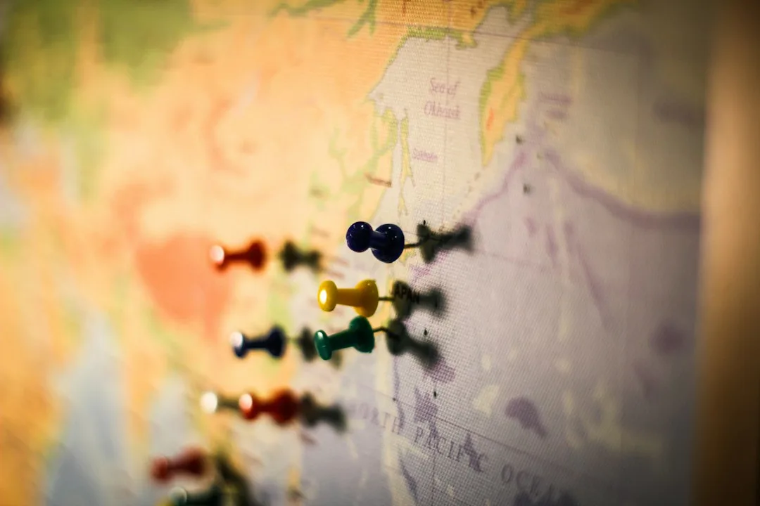
Territory: Every time you reach a decision, you are not acting on the world. You are acting on a small, simplified picture of the world that lives in your head: a mental map of how things work, what causes what, and what is likely to happen next. That map is indispensable.
Reality is too vast and too detailed to navigate directly, so the mind compresses it into manageable representations, the way a paper map compresses a sprawling city into lines on a page. The trouble begins when we forget that we are reading a map at all, and start treating our simplified picture as if it were the full, living territory it stands for.
This confusion is so fundamental that the Polish-American scholar Alfred Korzybski built an entire discipline around naming it. The slogan he gave us, “the map is not the territory,” has since traveled from philosophy into science, business, therapy, and design, because the same error keeps reappearing wherever humans use models to understand a complex world.
Understanding the gap between map and territory is not an academic nicety. It is one of the most practical mental skills a person can develop, because almost every serious failure of judgment, from a misdiagnosed patient to a collapsed financial market, is in some sense a moment when a trusted map quietly stopped matching the ground.
“A map is not the territory it represents, but, if correct, it has a similar structure to the territory, which accounts for its usefulness.” - Alfred Korzybski, Science and Sanity (1933)
Key Definitions
The territory is reality itself: the full, irreducibly complex state of the world, with all its detail, exceptions, and ongoing change. The map is any representation we build of that reality, whether it is a literal diagram, a scientific theory, a financial model, a stereotype, a memory, or a word.
A model is a deliberately simplified map built to serve a purpose. Models are useful precisely because they leave things out; a map that reproduced every detail of the territory would be as large and as useless as the territory itself. The danger lies not in simplification but in reification: treating an abstraction as if it were a concrete thing, mistaking the model for the reality it was meant to describe.
The phrase “the map is not the territory” therefore expresses a discipline of mind, not a rejection of maps. It asks us to use representations fully while never forgetting their three permanent limitations: a map leaves things out, a map reflects the mapmaker, and a map can fall out of date.
Korzybski and General Semantics
Alfred Korzybski introduced the formulation in his 1933 book Science and Sanity, the founding text of a field he called general semantics. The expression had appeared two years earlier, in a paper he delivered to the American Association for the Advancement of Science in New Orleans in December 1931, which he later reprinted in the book.
His central worry was that human beings habitually confuse words and symbols with the things they refer to, and that this confusion produces a great deal of unnecessary conflict and bad thinking. We argue about the word “freedom” as if the word were the thing; we react to a label on a person as if the label captured them entirely.
Korzybski’s antidote was to keep the structural relationship between map and territory constantly in view. A good map, he argued, is useful because it shares a similar structure with the territory, not because it copies it. The lines on a road map are not roads, but their relative positions correspond to the roads’ relative positions, and that correspondence is what lets the map guide you.
The moment we expect more from a map than structural correspondence, we are setting ourselves up to be misled.
General semantics offered a battery of techniques for keeping this distinction alive in everyday thought. Korzybski urged people to index their words, to remember that no two things labeled by the same noun are identical, and that the same thing changes over time. The chair you sit in is not the abstract category “chair,” and the person you met last year is not exactly the person you meet today.
These habits sound pedantic, but their point is humane: most of the rigidity and cruelty in human affairs, Korzybski believed, comes from collapsing the rich, shifting territory of a person or situation into a fixed verbal label and then reacting to the label instead of the reality.
“The map is not the territory, and the name is not the thing named.” - Alfred Korzybski, Science and Sanity (1933)
Borges and the Map That Failed
Long before management consultants discovered the phrase, the writer Jorge Luis Borges captured its deepest paradox in a one-paragraph story, “On Exactitude in Science” (1946). In an imaginary empire, cartographers grow so ambitious that they draw a map on the same scale as the empire itself, a map that coincides with the territory point for point.
“In that Empire, the Art of Cartography attained such Perfection that the map of a single Province occupied the entirety of a City, and the map of the Empire, the entirety of a Province. In time, those Unconscionable Maps no longer satisfied, and the Cartographers Guilds struck a Map of the Empire whose size was that of the Empire, and which coincided point for point with it.” - Jorge Luis Borges, “On Exactitude in Science” (1946)
The fable’s punchline is that the perfect map is worthless. Future generations let it rot in the desert, because a representation that omits nothing offers no compression and therefore no understanding. Borges shows that the usefulness of a map depends entirely on what it throws away.
A map’s omissions are not its defects; they are its function. This is why “make the model more detailed” is so often the wrong response to a model that has misled you. The real question is never how to eliminate simplification but whether the right things were simplified.
It is worth pausing on how counterintuitive this is. Our instinct, when a forecast fails or a plan goes wrong, is to demand more information, more variables, more granularity. Borges warns that detail has a cost as well as a benefit. Beyond some point, added detail does not sharpen a map; it drowns it, until the representation becomes as unwieldy as the thing it was meant to simplify. A good map is an act of ruthless, intelligent neglect. The art lies in knowing what to ignore.
Why Every Useful Model Is Wrong
The statistician George Box gave the idea its most quoted scientific form. Working on industrial process control, he insisted that the question of whether a model is true is the wrong question entirely; the only question worth asking is whether it is useful for a particular purpose.
“All models are wrong, but some are useful.” - George E. P. Box, in Robustness in Statistics (1979)
Box’s point is liberating rather than cynical. A model of a gas that treats molecules as perfect spheres is wrong in detail, yet it predicts pressure and temperature well enough to design engines. A weather model cannot track every air molecule, yet it saves lives.
The skill of the scientist, the engineer, and the decision-maker is not to find the one true model but to know which wrong model is wrong in ways that do not matter for the task at hand. Trouble arrives when a model that is useful in one regime is carried, unexamined, into a regime where its particular wrongness suddenly matters a great deal.
| Map | What It Usefully Captures | What It Necessarily Omits |
|---|---|---|
| Subway map | The order and connections of stations | True distances, surface geography, walking routes |
| GDP | Aggregate market activity | Inequality, unpaid work, environmental cost, wellbeing |
| A medical diagnosis | A pattern matching known disease categories | The individual patient’s full physiology and history |
| A personality label | A rough behavioral tendency | The person’s range, context, and capacity to change |
The Three Ways Maps Mislead
Maps fail in patterned ways, and learning the patterns is the heart of the discipline. The first failure is omission: every map leaves something out, and disaster strikes when the omitted detail turns out to be the one that mattered. The financial models that preceded the 2008 crisis treated certain rare, correlated events as nearly impossible; the territory disagreed. The map was not stupid, but its silence about tail risk was catastrophic.
The second failure is bias: every map reflects the assumptions, interests, and vantage point of whoever drew it. The cartographer chooses the projection, the categories, the center of the page. A map is never a neutral mirror of reality; it is an argument about which features of reality matter.
The familiar Mercator projection, for instance, preserves angles for navigation but badly inflates the size of high-latitude regions, quietly shaping generations of intuitions about the relative size of continents.
The third failure is staleness: territories change, and maps do not change with them automatically. A model of consumer behavior built in 2015 may describe a world that no longer exists. The danger is greatest when a map has worked well for years, because long success breeds the confidence that lets us stop checking the map against the ground.
| Failure Mode | What Goes Wrong | Guarding Question |
|---|---|---|
| Omission | A crucial detail was left out of the model | What is this map silent about? |
| Bias | The map encodes the mapmaker’s vantage point | Who drew this, and what did they assume? |
| Staleness | The territory changed but the map did not | When was this last checked against reality? |
Reification and the Tyranny of the Metric
The most insidious version of the error happens when an organization builds a map, declares it the official reality, and then acts only on the map. A number that began as a rough proxy for something we care about becomes the target itself, and people optimize the proxy while the underlying reality drifts away. This is the mechanism behind Goodhart’s law: when a measure becomes a target, it ceases to be a good measure.
Consider standardized test scores as a proxy for learning, hospital wait times as a proxy for care quality, or quarterly earnings as a proxy for the health of a company. Each is a useful map of something hard to see directly. Each becomes dangerous the moment it is mistaken for the territory, because human beings are extraordinarily good at improving the visible number without improving the invisible thing it was supposed to represent.
Teaching to the test, gaming wait-time definitions, and sacrificing long-term value for a good quarter are all the same error: confusing the metric with the reality it abstracts.
The deeper lesson is that no measurement is innocent. The very act of choosing what to count broadcasts what an institution believes is important, and over time the institution becomes the kind of place that produces good numbers rather than the kind of place the numbers were meant to describe. The cure is not to abandon measurement, which would be its own kind of blindness, but to keep asking what each number leaves out and to pair every metric with a habit of looking directly at the thing it stands for.
Mental Models and the Mind’s Maps
The map-territory distinction is not only about external diagrams and spreadsheets. The mind itself runs on internal maps. Cognitive scientists call them mental models or schemas: compact internal representations of how some part of the world behaves, assembled from experience and used to predict, explain, and act.
You have a mental model of how a car works, how your colleague is likely to react, and how a conversation should unfold. These models let you function without re-deriving the world from scratch each morning.
But the same compression that makes mental models powerful makes them prone to every map failure. A stereotype is a mental map that has hardened into reification, applied to people whose territory it never fit. A first impression is a hastily drawn map mistaken for a finished one.
Confirmation bias is, in map terms, the refusal to update a map when the territory sends contradicting signals. Much of what we call wisdom is simply the habit of holding mental maps loosely, treating them as provisional sketches to be revised rather than as the ground truth itself.
“We see the world, not as it is, but as we are, or, as we are conditioned to see it.” - Stephen R. Covey, The 7 Habits of Highly Effective People (1989)
Maps in Science: Models as Tools, Not Truths
Science is the most disciplined map-making enterprise humans have built, and its history is a long lesson in not confusing maps with territory. Newtonian mechanics was treated for two centuries as a literal description of reality, until Einstein showed it was a superb local map that breaks down near the speed of light and in strong gravity. Newton’s laws were not discarded; engineers still use them to land spacecraft, because in everyday regimes they are wrong in ways that do not matter.
They were demoted from territory to map.
The atom-as-tiny-solar-system, the gene-as-blueprint, the brain-as-computer: each is a model that illuminated a great deal and then, taken too literally, began to mislead. The mature scientific attitude treats theories as the best current maps, powerful and provisional, always one good experiment away from revision. The non-scientific instinct, by contrast, reaches for certainty and converts whatever model it trusts into an article of faith.
The difference between the two is precisely the difference between knowing you hold a map and believing you hold the territory.
This is also why good science institutionalizes doubt. Peer review, replication, error bars, and confidence intervals are all rituals for keeping the gap between map and territory in view. A reported result is not a fact about the world but a claim about a model, hedged with an estimate of how far the model might be wrong. When that hedging is stripped away, in a headline or a boardroom slide, the map quietly hardens back into territory, and the discipline that made it trustworthy is lost.
The Animal Dimension
Animals navigate by internal maps too, and studying them reveals how deeply the map-territory relationship is built into nervous systems. In the early 1970s, John O’Keefe discovered place cells in the rat hippocampus: individual neurons that fire only when the animal occupies a specific location in its environment, together forming a neural representation of space.
Decades later, May-Britt and Edvard Moser discovered grid cells in the nearby entorhinal cortex, neurons that fire in a striking triangular lattice as the animal moves, supplying a kind of internal coordinate system. The three shared the 2014 Nobel Prize in Physiology or Medicine for revealing what amounts to a literal map of the territory drawn in cells.
Crucially, this neural map is a model, not a copy. It is built from the animal’s own movement and experience, it can be distorted or fooled, and it must be continually updated as the environment changes, exactly like every other map we have discussed. The desert ant Cataglyphis offers a complementary case: it navigates by path integration, continuously updating an internal vector that points home, a built-in model of its position.
This works beautifully until experimenters displace the ant, at which point it confidently runs out the homeward vector and begins searching at the spot where home would be if the map were still accurate. The ant trusts its map over the territory, and in the altered world the map leads it astray.
It is the cleanest possible illustration of the principle, performed by an insect whose brain weighs a fraction of a milligram.
The lesson runs deeper than a charming anecdote. Path integration is a model precisely because it accumulates small errors and cannot, on its own, detect that the world has moved. Real desert ants compensate by correcting their internal vector against visual landmarks and the pattern of polarized light in the sky, layering a second map over the first.
Robust navigation, in ants as in institutions, comes not from any single perfect map but from cross-checking several imperfect ones against the territory and against each other.
Practical Implications
The discipline of distinguishing map from territory turns into a small set of durable habits. The first is to ask, of any model you rely on, what it leaves out, and whether the omission is safe for your particular purpose. The second is to identify who built the map and what they assumed, because every representation smuggles in a vantage point.
The third is to check the map against the territory directly and regularly, especially when it has worked well for a long time, since that is exactly when complacency sets in.
The fourth habit is to resist reification in language. When you catch yourself treating a metric, a label, a forecast, or a theory as the thing itself rather than as a representation of it, you have found the error in the act. Korzybski’s whole program was to build this catch into ordinary speech, to keep the gap between word and thing perpetually visible. You do not have to adopt his vocabulary to adopt his vigilance.
None of this argues against models. We cannot think without them, and the alternative to a flawed map is not the raw territory but a worse map or no map at all. The goal is to hold the best available map firmly enough to act and loosely enough to revise, to extract every drop of usefulness from a representation while never granting it the authority of reality.
The wise navigator and the wise scientist share one trait above all: a steady awareness that the elegant picture in front of them is a tool for engaging the world, never a substitute for looking at it. The map is not the territory, and the cost of forgetting it is measured in everything from wrong turns to ruined institutions to lives.
Related Resources
- Mental Models: How to Think Better
- Confirmation Bias: Why We See What We Expect
- What Is Cognitive Load Theory
- Goodhart’s Law: When a Measure Becomes a Target
References
- Korzybski, A. (1933). Science and Sanity: An Introduction to Non-Aristotelian Systems and General Semantics. Institute of General Semantics.
- Borges, J. L. (1946). On Exactitude in Science. In Collected Fictions (A. Hurley, Trans., 1998). Penguin.
- Box, G. E. P. (1979). Robustness in the strategy of scientific model building. In R. L. Launer & G. N. Wilkinson (Eds.), Robustness in Statistics (pp. 201-236). Academic Press. https://doi.org/10.1016/B978-0-12-438150-6.50018-2
- O’Keefe, J., & Dostrovsky, J. (1971). The hippocampus as a spatial map: Preliminary evidence from unit activity in the freely-moving rat. Brain Research, 34(1), 171-175. https://doi.org/10.1016/0006-8993(71)90358-1
- Hafting, T., Fyhn, M., Molden, S., Moser, M.-B., & Moser, E. I. (2005). Microstructure of a spatial map in the entorhinal cortex. Nature, 436(7052), 801-806. https://doi.org/10.1038/nature03721
- Wehner, R., & Srinivasan, M. V. (1981). Searching behaviour of desert ants, genus Cataglyphis (Formicidae, Hymenoptera). Journal of Comparative Physiology A, 142(3), 315-338. https://doi.org/10.1007/BF00605445
- Covey, S. R. (1989). The 7 Habits of Highly Effective People. Free Press.