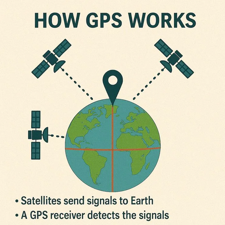
Functions: GPS (Global Positioning System) works by measuring how long it takes radio signals to travel from orbiting satellites to your receiver, then using those travel times to calculate your exact position through a process called trilateration.
Each of the 31 operational GPS satellites orbiting Earth at approximately 20,200 kilometers altitude continuously broadcasts its precise position and the exact time the signal was transmitted using onboard atomic clocks.
Your phone or GPS device captures these signals, measures the tiny differences in arrival times, and uses the known speed of light to calculate how far away each satellite is.
With distances from at least four satellites, the receiver can pinpoint your location in three dimensions - latitude, longitude, and altitude - to within a few meters, or even centimeters with professional-grade equipment.
The system was developed by the United States Department of Defense starting in the 1970s and became fully operational in April 1995.
Originally designed for military navigation and precision-guided munitions, GPS was opened to civilian use after Korean Air Lines Flight 007 was shot down in September 1983 after straying into Soviet airspace due to a navigation error.
The tragedy killed all 269 people aboard and prompted President Ronald Reagan to commit to making the GPS system available for civilian aviation safety.
Today GPS underpins not just navigation but financial transaction timestamping, power grid synchronization, cellular network timing, scientific research, precision agriculture, and autonomous vehicle guidance - a global infrastructure so pervasive that its failure would cascade through virtually every sector of modern civilization.
Understanding how GPS actually functions reveals why it is both more impressive and more fragile than it appears. The precision required is extraordinary: a timing error of one microsecond produces a position error of 300 meters. The signals are extraordinarily weak.
The system depends on corrections for atmospheric delays, relativistic effects predicted by Einstein, and satellite clock drift. And the satellites themselves require constant monitoring and updating from ground control stations operated 24 hours a day.
"GPS is a wonder of the modern world. Its signals are so weak they are buried beneath the noise floor, yet from these whispers we extract position to the width of a human hair." - Bradford Parkinson, lead architect of GPS, speaking at the National Academy of Engineering (2003)
The History of GPS: From Military Secret to Global Utility
The Origins
The conceptual foundation of satellite navigation dates to 1957, when two physicists at the Johns Hopkins Applied Physics Laboratory - William Guier and George Weiffenbach - realized they could determine the orbit of the newly launched Sputnik satellite by measuring the Doppler shift of its radio signal.
Their supervisor, Frank McClure, immediately saw the inverse possibility: if you knew the satellite's orbit precisely, you could use the same Doppler measurements to determine your own position on the ground.
This insight led to the Transit system (also called NAVSAT), the first operational satellite navigation system, which became available to the US Navy in 1964. Transit worked, but it was slow - a position fix required tracking a satellite for 10-15 minutes - and inaccurate by modern standards (approximately 200 meters).
It was sufficient for submarines surfacing to update their inertial navigation systems but inadequate for real-time navigation.
In 1973, Colonel Bradford Parkinson was tasked with creating a unified satellite navigation system for the Department of Defense.
His team at the GPS Joint Program Office designed the system architecture that, with refinements, still operates today: a constellation of satellites in medium Earth orbit, each broadcasting precisely timed signals, with receivers on the ground computing position from simultaneous measurements of multiple satellite signals.
The first GPS satellite, Navstar 1, was launched in February 1978. The constellation was declared fully operational on April 27, 1995, with 24 satellites covering the entire globe.
Selective Availability and Civilian Access
For the first several years of civilian GPS availability, the US military deliberately degraded the civilian signal through a process called Selective Availability (SA), introducing intentional errors that limited civilian accuracy to approximately 100 meters.
This was intended to prevent adversaries from using GPS for precision targeting while still allowing civilian navigation.
President Bill Clinton ordered Selective Availability turned off on May 1, 2000, immediately improving civilian GPS accuracy from approximately 100 meters to approximately 10-15 meters.
This single policy decision unleashed the explosion of GPS-dependent consumer technology - turn-by-turn navigation, location-based services, geotagging, ride-hailing apps - that now defines modern life.
The Department of Defense committed in 2007 to never reactivate SA and designed the next generation of GPS satellites (Block III) without the capability.
The GPS Satellite Constellation
Orbital Configuration
The GPS constellation consists of at least 24 operational satellites (currently 31, with spares) distributed across six orbital planes, each inclined at 55 degrees to the equator. The orbital planes are separated by 60 degrees in longitude.
This arrangement ensures that at least four satellites are visible from virtually anywhere on Earth at any time, with most locations seeing 6-12 simultaneously.
The satellites orbit at medium Earth orbit (MEO), approximately 20,200 kilometers altitude, with an orbital period of approximately 11 hours and 58 minutes - each satellite completes slightly more than two orbits per day.
This altitude was chosen carefully: low enough that signal travel times are measurable with useful precision, high enough that each satellite covers a large footprint on Earth's surface, and at an orbital period that ensures the constellation geometry repeats (nearly) every sidereal day.
The 2nd Space Operations Squadron at Schriever Space Force Base in Colorado Springs operates the ground control segment, monitoring all satellites continuously and uploading corrections, updated ephemeris data, and clock corrections at least twice per day through a network of ground antennas located around the world.
What Each Satellite Broadcasts
Each GPS satellite continuously transmits a signal containing three critical pieces of information:
- The satellite's precise position in space (ephemeris data) - orbital parameters that allow the receiver to calculate exactly where the satellite is at any given moment
- The exact time the signal was transmitted - from the satellite's onboard atomic clocks, accurate to nanoseconds
- Health and status information - including almanac data (coarse orbital positions of all satellites in the constellation) and correction parameters
The signal is transmitted on multiple radio frequencies. The primary civilian signal is on the L1 frequency at 1575.42 MHz. A second civilian signal on L2 (1227.60 MHz) allows dual-frequency receivers to measure and correct for ionospheric delay.
A third civilian signal, L5 (1176.45 MHz), was added as part of GPS modernization beginning with the Block IIF satellites and provides higher signal strength specifically for safety-of-life applications like aviation.
The newest Block III satellites, first launched in 2018, broadcast an additional civilian signal called L1C, designed for interoperability with Europe's Galileo system.
Global Navigation Satellite Systems Compared
GPS is no longer the only game in orbit. Multiple nations have built or are building their own systems:
| System | Operator | Satellites (approx.) | Coverage | Civilian Accuracy | Operational Since |
|---|---|---|---|---|---|
| GPS (Navstar) | United States (Space Force) | 31 | Global | 3-5 m | 1995 |
| GLONASS | Russia (Roscosmos) | 24 | Global | 2-4 m | 2011 (restored) |
| Galileo | European Union (ESA/GSA) | 28 | Global | ~1 m (standard) | 2023 (full) |
| BeiDou (BDS-3) | China (CNSA) | 35+ | Global | 2-5 m | 2020 |
| QZSS (Michibiki) | Japan (Cabinet Office) | 7 | Asia-Pacific regional | Sub-meter (augmented) | 2018 |
| NavIC (IRNSS) | India (ISRO) | 7 | South Asia regional | ~5 m | 2018 |
Atomic Clocks: The Heart of GPS
Why Precision Timing Matters
GPS accuracy is fundamentally limited by timing precision. Radio signals travel at the speed of light: approximately 299,792 kilometers per second, or about 30 centimeters per nanosecond (one billionth of a second).
A timing error of just one microsecond (one millionth of a second) produces a distance error of approximately 300 meters. One nanosecond of error produces 30 centimeters of position error.
This is why GPS satellites carry atomic clocks rather than ordinary timekeeping devices. Each satellite carries two or three atomic clocks - typically rubidium vapor clocks and, on newer satellites, improved rubidium or hydrogen maser clocks.
These are accurate to approximately 1-3 nanoseconds per day. They are so stable that, without external correction, they would drift by only about one second every 100,000 years. The ground control segment monitors these clocks continuously and uploads corrections when drift is detected.
The total GPS system represents the most precise timekeeping network ever constructed. The US Naval Observatory, which maintains the master clock for GPS, keeps time accurate to within a few nanoseconds of Coordinated Universal Time (UTC).
This precision has made GPS the de facto global time distribution system - financial exchanges, telecommunications networks, and power grids around the world synchronize their clocks to GPS time.
Relativistic Corrections: Einstein in Your Pocket
GPS engineers face a fascinating complication from Albert Einstein's theories of relativity - making GPS one of the few technologies that would not work without relativistic corrections.
Special relativity (1905) predicts that a clock moving relative to an observer runs slower (time dilation). GPS satellites orbit at approximately 14,000 km/h relative to the ground, causing their clocks to run approximately 7 microseconds per day slower than ground clocks.
General relativity (1915) predicts the opposite effect: a clock in a weaker gravitational field runs faster. GPS satellites, orbiting at 20,200 km altitude, experience weaker gravity than clocks on Earth's surface, causing their clocks to run approximately 45 microseconds per day faster than ground clocks.
The net effect: satellite clocks run approximately 38 microseconds per day faster than ground clocks. Over a single day without correction, this would accumulate a position error of approximately 11 kilometers - rendering the system useless for navigation.
GPS satellite clocks are pre-programmed to run at a slightly lower frequency (10.22999999543 MHz instead of 10.23 MHz) to cancel this relativistic offset.
Neil Ashby of the University of Colorado published the definitive analysis of relativistic effects in GPS in a 2003 Living Reviews in Relativity paper, calling GPS "a practical application of Einstein's general theory of relativity."
How Position Is Calculated
Trilateration Explained
The mathematical principle behind GPS positioning is trilateration - determining position by measuring distances from known reference points. (This is distinct from triangulation, which uses angles rather than distances.)
With one satellite's known position and the calculated distance from your receiver to that satellite, you know you must be somewhere on a sphere of that radius centered on the satellite. With two satellites, you are somewhere on the circle formed by the intersection of two spheres.
With three satellites, you are at one of two points where three spheres intersect. In practice, one of those points is deep in space and the other is on or near Earth's surface, so the receiver selects the physically plausible solution.
The fourth satellite resolves the receiver clock error. Unlike the satellites' atomic clocks, your phone's GPS chip uses a cheap quartz crystal oscillator that drifts by milliseconds - far too much for GPS.
By incorporating a fourth satellite measurement, the receiver can solve for four unknowns simultaneously: latitude, longitude, altitude, and receiver clock error.
This is why GPS degrades gracefully: three satellites give a two-dimensional fix (latitude and longitude only, assuming a known altitude), and each additional satellite beyond four improves accuracy through overdetermined solutions and statistical averaging.
Sources of Error and Correction
GPS position errors arise from multiple sources, each requiring different mitigation strategies:
Ionospheric delay: The ionosphere (approximately 50-1,000 km altitude) is a layer of electrically charged particles that slows GPS signals. The delay varies by time of day, solar activity, season, and signal frequency.
Dual-frequency receivers measure signals on L1 and L2 simultaneously and calculate the differential delay, which allows the ionospheric error to be largely removed.
Single-frequency receivers use the Klobuchar model (a mathematical approximation broadcast in the satellite signal) to estimate and partially correct for ionospheric delay, reducing the error by approximately 50%.
Tropospheric delay: The lower atmosphere (troposphere, 0-12 km altitude) also slows signals, with effects that depend on humidity, temperature, and barometric pressure.
The tropospheric delay is typically 2-3 meters at zenith and increases as the satellite elevation angle decreases (signals passing through more atmosphere). Models like the Saastamoinen model can reduce but not eliminate this error.
Satellite geometry (PDOP): Position Dilution of Precision measures how satellite geometry affects positioning accuracy. When visible satellites are clustered together in one part of the sky, the geometric intersections are poorly defined and errors amplify.
When satellites are spread across the sky, geometry is good and errors are minimized. A PDOP below 2 is excellent; above 6 is poor. The GPS constellation was specifically designed so that satellite geometry is favorable from any point on Earth.
Multipath: In urban environments, signals reflect off buildings, vehicles, and other surfaces and arrive at the receiver via an indirect path, creating false distance calculations. Multipath is one of the hardest error sources to correct and can add errors of several meters in dense urban canyons.
Receivers mitigate multipath through antenna design, signal processing algorithms, and increasingly through detailed 3D maps of urban environments.
Satellite clock and ephemeris errors: Despite atomic precision, satellites accumulate small clock errors and their actual positions deviate slightly from the broadcast ephemeris predictions. The ground control segment corrects for these by uploading fresh data, but between updates, residual errors of 1-2 meters are typical.
GPS Accuracy: Consumer vs. Professional Grade
Standard Consumer GPS
Standard consumer GPS in smartphones achieves horizontal accuracy of approximately 3-5 meters under good conditions (open sky, favorable geometry, modern multi-constellation receiver).
This is sufficient for turn-by-turn navigation, fitness tracking, geotagging photos, and most consumer applications. Under challenging conditions (urban canyons, dense tree canopy, near buildings), accuracy may degrade to 10-20 meters.
Professional Accuracy Enhancement
Professional applications push accuracy far beyond what consumer devices achieve:
Differential GPS (DGPS) uses a network of fixed, precisely surveyed ground stations that compare their GPS-calculated position to their known position, compute the correction, and broadcast it to GPS receivers in the area. DGPS improves accuracy to approximately 1-3 meters and is used in maritime navigation and some aviation applications.
Real-Time Kinematic (RTK) systems use carrier phase measurements rather than just code-based timing, achieving centimeter-level accuracy (1-2 cm horizontal). RTK requires a base station within about 10-40 km and a radio or cellular data link between base and rover.
It is used in professional surveying, precision agriculture (guiding tractors to centimeter accuracy), construction machine guidance, and increasingly in autonomous vehicle development. The global RTK corrections market was valued at approximately $3.2 billion in 2023 (Grand View Research).
Precise Point Positioning (PPP) achieves centimeter accuracy without a local base station by using precise satellite orbit and clock corrections distributed over the internet. PPP requires longer convergence times (15-30 minutes) but offers global coverage.
Wide Area Augmentation System (WAAS) in the US, EGNOS in Europe, and MSAS in Japan provide free differential correction signals broadcast from geostationary satellites, improving accuracy to approximately 1-3 meters for aviation and general use.
Assisted GPS in Smartphones
The Cold Start Problem
A GPS receiver that has been powered off for an extended period (or moved far while off) faces a cold start problem. It must download fresh ephemeris data directly from the satellites. This data is broadcast at a slow 50 bits per second - it takes 12.5 minutes to receive a complete navigation message under ideal conditions.
The receiver must maintain an unobstructed sky view throughout, and signal acquisition without knowing which satellites to look for is slow.
How A-GPS Solves It
Assisted GPS (A-GPS) solves the cold start problem by delivering ephemeris and almanac data over a mobile data connection (cellular network or Wi-Fi).
Your phone requests this data from an assistance server, receives it nearly instantly, and can immediately begin searching for the correct satellite signals rather than waiting to download them from orbit.
A-GPS also uses the phone's cellular network to obtain a coarse initial position estimate from cell tower locations, accurate to a few hundred meters. This tells the GPS chip roughly where it is, dramatically reducing the satellite search space and cutting time to first fix (TTFF) from minutes to a few seconds.
In practice, a modern smartphone with A-GPS typically achieves a position fix in 2-5 seconds, compared to 30 seconds to several minutes for a standalone GPS receiver performing a cold start.
Modern smartphone GNSS chips from Qualcomm (Snapdragon), Broadcom, and MediaTek support multiple satellite constellations simultaneously (GPS, GLONASS, Galileo, BeiDou), potentially tracking signals from 30-40 satellites at once.
This multi-constellation approach provides more satellites to choose from and dramatically improves performance in difficult environments like urban canyons.
Why GPS Fails Indoors
Signal Strength and Building Attenuation
GPS signals arrive at Earth's surface at an extraordinarily low power level - roughly -130 dBm, which is approximately 0.00000000000000001 watts (10 femtowatts).
Bradford Parkinson described GPS signals as "a 20-watt light bulb viewed from 20,000 kilometers away." While GPS receivers are engineered to detect signals at this level using sophisticated correlation techniques, they have almost no margin for additional attenuation.
Concrete walls attenuate GPS signals by 10-20 dB. Metal and reinforced structures can attenuate by 20-30 dB or more, effectively making the signals undetectable. Even standard glass reduces signal strength.
Signals that do penetrate buildings are often multipath reflections that have traveled indirect paths, producing position errors of tens or hundreds of meters.
Indoor Positioning Alternatives
When GPS signals are unavailable, smartphones fall back to a hierarchy of alternative positioning methods:
Wi-Fi positioning: Databases maintained by Apple, Google, and other companies map the locations of hundreds of millions of Wi-Fi access points worldwide.
When your phone scans available networks and matches their identifiers against the database, it can estimate position to within 15-40 meters in urban areas. This is why keeping Wi-Fi enabled (even without connecting to a network) improves smartphone positioning indoors.
Cell tower positioning: The phone estimates its position from the known locations of cellular towers it can communicate with, using signal strength and timing measurements. Accuracy ranges from approximately 50 meters in dense urban areas (with many towers) to several kilometers in rural areas with sparse coverage.
Inertial navigation (dead reckoning): Modern phones contain accelerometers, gyroscopes, magnetometers, and barometers. These sensors track movement direction, speed, and altitude changes, maintaining a continuously updated position estimate when satellite signals are unavailable.
The accuracy degrades over time as small errors accumulate, but for short indoor navigation segments (walking through a building), it is effective.
Bluetooth beacons: Shopping malls, airports, and large buildings increasingly deploy Bluetooth Low Energy (BLE) beacons that enable indoor positioning to approximately 1-3 meter accuracy for devices with the appropriate software.
GPS Vulnerabilities: Jamming and Spoofing
The Fragility of Weak Signals
The extreme weakness of GPS signals makes them vulnerable to both unintentional and intentional interference. A GPS jammer - a device that broadcasts noise on GPS frequencies - can deny GPS service over a significant area with very little transmit power.
Jammers small enough to plug into a car's cigarette lighter socket are widely available (though illegal in most countries) and are used by truck drivers to defeat fleet tracking systems, inadvertently disrupting GPS for surrounding areas.
GPS spoofing is a more sophisticated attack: transmitting fake GPS signals that cause receivers to calculate an incorrect position or time.
Todd Humphreys and his team at the University of Texas at Austin demonstrated in 2013 that a spoofing device costing under $3,000 could take control of a yacht's navigation system and steer it off course without triggering any alarms.
The implications for aviation, autonomous vehicles, and financial systems that depend on GPS timing are serious.
Critical Infrastructure Dependence
The US Department of Homeland Security identified GPS as a single point of failure for 16 critical infrastructure sectors. The financial industry alone depends on GPS timing for transaction timestamping, with the New York Stock Exchange and other major exchanges synchronizing their clocks to GPS.
The 2019 GPS rollover event (when the GPS week counter reset to zero) prompted widespread concern about systems that might misinterpret the date.
Mitigation strategies include Receiver Autonomous Integrity Monitoring (RAIM), which cross-checks satellite signals for consistency, and multi-constellation receivers that are much harder to spoof because an attacker would need to simultaneously fake signals from GPS, GLONASS, Galileo, and BeiDou.
The European Union's Galileo system includes an encrypted authentication service specifically designed to prevent spoofing.
Practical Takeaways
For everyday navigation, standard GPS accuracy of 3-5 meters is more than sufficient for driving, cycling, or walking. The limiting factor is usually map quality and signal update rate, not GPS accuracy itself.
If positioning in urban environments is unreliable, enable location services that use all available positioning methods (GPS, Wi-Fi, cellular). Keeping Wi-Fi on, even without connecting to a network, significantly improves urban positioning.
For professional surveying, precision agriculture, or construction requiring centimeter accuracy, RTK GPS with a local base station or subscription network correction service (such as Trimble's RTX or Leica's SmartNet) is necessary.
GPS signal jamming and spoofing are genuine threats to critical infrastructure and personal safety. Multi-constellation receivers and RAIM provide the best currently available defense for consumer and professional users.
Battery impact from GPS varies significantly by use case. Continuous navigation uses GPS hardware and processors continuously and can drain a smartphone battery 2-3 times faster than normal use. Background location tracking with lower update rates has much less impact.
For related topics, see how does the internet work, how do self-driving cars work, what is precision agriculture, and how does encryption work.
Sources & Further Reading
- Kaplan, E. D., & Hegarty, C. J. (2017). Understanding GPS/GNSS: Principles and Applications (3rd ed.). Artech House.
- Parkinson, B. W., & Spilker, J. J. (1996). Global Positioning System: Theory and Applications (Vols. 1-2). American Institute of Aeronautics and Astronautics.
- Ashby, N. (2003). Relativity in the Global Positioning System. Living Reviews in Relativity, 6(1). DOI: 10.12942/lrr-2003-1
- Misra, P., & Enge, P. (2006). Global Positioning System: Signals, Measurements, and Performance (2nd ed.). Ganga-Jamuna Press.
- Humphreys, T. E., et al. (2008). Assessing the Spoofing Threat: Development of a Portable GPS Civilian Spoofer. Proceedings of the ION GNSS Conference. DOI: 10.33012/2008.15375
- US Department of Defense. (2020). GPS Standard Positioning Service Performance Standard (5th ed.).
- European GNSS Agency. (2023). Galileo System Status and Programme Overview.View source
- Hofmann-Wellenhof, B., Lichtenegger, H., & Wasle, E. (2008). GNSS: Global Navigation Satellite Systems - GPS, GLONASS, Galileo, and More. Springer.
- National Coordination Office for Space-Based Positioning, Navigation, and Timing. GPS.gov. View source
- Zumberge, J. F., Heflin, M. B., Jefferson, D. C., Watkins, M. M., & Webb, F. H. (1997). Precise Point Positioning for the Efficient and Robust Analysis of GPS Data from Large Networks. Journal of Geophysical Research, 102(B3), 5005-5017. DOI: 10.1029/96JB03860
- US Department of Homeland Security. (2020). GPS Disruption and Its Impacts on Critical Infrastructure. Cybersecurity and Infrastructure Security Agency (CISA).
- Grand View Research. (2023). GNSS Correction Service Market Size, Share & Trends Analysis Report.View source
Frequently Asked Questions
How does GPS determine your location?
GPS determines location through a process called trilateration. Each GPS satellite continuously broadcasts a signal containing its precise position and the exact time the signal was sent. Your GPS receiver picks up signals from multiple satellites and calculates how long each signal took to arrive. Since signals travel at the speed of light (approximately 300,000 km per second), the receiver can calculate its distance from each satellite. With distances from at least three satellites, the receiver can calculate a two-dimensional position. A fourth satellite is needed to correct for clock errors in the receiver and determine altitude. Modern receivers typically use signals from 8-12 satellites simultaneously for improved accuracy.
Why are atomic clocks essential to GPS?
GPS depends on extraordinarily precise timing. Since signals travel at the speed of light, a timing error of just one microsecond (one millionth of a second) translates to a position error of about 300 meters. Each GPS satellite carries multiple atomic clocks accurate to about 20-30 nanoseconds (billionths of a second). GPS receivers contain cheaper quartz clocks that are far less accurate, but they compensate by using signals from four or more satellites to solve for both position and the receiver’s clock error simultaneously. Without atomic clock precision in the satellites, the entire system would be unusable for navigation.
Why is GPS less accurate indoors?
GPS signals travel at radio frequencies (L1 at 1575.42 MHz) and are extremely weak by the time they reach Earth’s surface, about 20 to 50 watts from the satellite is received at less than a billionth of a watt at your device. Building materials, concrete, metal, thick walls, attenuate and reflect these signals. Indoors, the receiver may receive only reflected (multipath) signals rather than direct satellite signals, producing significant position errors. The receiver may also lose contact with enough satellites for a valid position fix. This is why GPS-dependent applications like navigation apps default to Wi-Fi positioning or cell tower triangulation when satellite signals are unavailable indoors.
What is Assisted GPS (A-GPS) and how does it work?
Assisted GPS (A-GPS) is a technique used in smartphones and other mobile devices to speed up the time to first fix and improve positioning when satellite signals are weak. A standard GPS receiver must download almanac and ephemeris data (satellite positions and orbital parameters) directly from satellite signals, which can take several minutes and requires a clear view of the sky. A-GPS delivers this data over a cellular or Wi-Fi data connection instead, dramatically reducing acquisition time from minutes to seconds. A-GPS also uses cell tower and Wi-Fi hotspot location data to provide a coarse initial position estimate, helping the receiver know which satellites to look for and reducing the search time.
What is the difference between GPS, GLONASS, and Galileo?
GPS (Global Positioning System) is operated by the US military and open for civilian use globally. GLONASS (Global Navigation Satellite System) is Russia’s equivalent system, with a similar constellation of satellites in medium Earth orbit. Galileo is the European Union’s civilian GNSS, designed for higher accuracy and independence from US and Russian military systems. Most modern smartphones receive signals from all three systems simultaneously (plus China’s BeiDou), which significantly improves accuracy and reliability because more satellites are visible at any time. Using multiple constellations also means better positioning in urban canyons where some satellites are blocked by buildings.